To order the Mountain High Maps V.4.0 Upgrade at preferential pricing for current owners at any version level please Contact us to Request Upgrade.
Mountain High Maps® is the world's only collection of relief
maps of the Earth's continents and ocean floors. The result of 20 years of
intense research and highly skilled engineering, Mountain High Maps®
provides a revolutionary way for you to dramatically enhance your maps - be they
for print, multimedia, web use or broadcasting.
Previously supplied mostly as grayscale TIFF images for coloring by the
designer, each of the 78 maps in version 4.0 comes in seven
versions - three pre-colorized, (one political and two physical) in addition
to the two grayscale and Illustrator files as well as several new maps
and 8,000 additional place names and physical features.
Reflecting the ever-changing political world, Mountain High Maps®
version 4.0 also updates all current borders and place names,
maintaining the product's unrivaled reputation for integrity, accuracy and
reliability.
The very high resolution of the maps is also without precedent in digital
media. Mountain High Maps® delivers between 500 to 1000 meters per
pixel in most areas, which is over ten times the resolution of other world mapping products.
 Meticulously detailed relief maps showing land relief, ocean floor relief
and country masks in TIFF and JPEG format.
Meticulously detailed relief maps showing land relief, ocean floor relief
and country masks in TIFF and JPEG format.
Seven variations of each map, including 3 pre-colorized - one political,
two physical, two grayscale and Illustrator formats.
Outline maps, borders, rivers, cities, latitude & longitude, and names up to 190 layers.
Each country on a separate layer prefilled with color.
Over 16,000 fully-editable place names and features in EPS.
Stunning globe views with cloud and starfield masks, in grayscale and colorized versions.
Quick Time or AVI revolving globes animations.
High resolution for quality output by imagesetter.
With map file sizes from 20 MB to 50 MB for sharper imagesetter output at letter
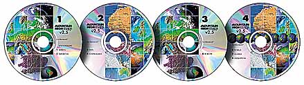
size and larger, the additional files have required extra CD's. The package now
comes as a four disc CD-ROM set for Macintosh and a four disc set for Windows -
a total of 10 GBytes of uncompressed files for either platform.
 There are now over 16,000 place names and labeled physical features
such as rivers, lakes and mountains. Masks enable the designer to colorize each
country and define its borders, highlight coastlines and add dramatic 3-D
effects with land mass shadow or vignette masks. Country outlines, borders,
rivers, graticules (lines of longitude and latitude), linear scales and place
names are supplied as fully editable Illustrator layers and are
also included as Photoshop paths - up to 191 for each map file - enabling almost
infinite customization, much of which is not possible with other mapping
software. For example, Mountain High Maps® is the only map-making
resource which includes detailed ocean floor relief!
There are now over 16,000 place names and labeled physical features
such as rivers, lakes and mountains. Masks enable the designer to colorize each
country and define its borders, highlight coastlines and add dramatic 3-D
effects with land mass shadow or vignette masks. Country outlines, borders,
rivers, graticules (lines of longitude and latitude), linear scales and place
names are supplied as fully editable Illustrator layers and are
also included as Photoshop paths - up to 191 for each map file - enabling almost
infinite customization, much of which is not possible with other mapping
software. For example, Mountain High Maps® is the only map-making
resource which includes detailed ocean floor relief!
All of the Illustrator paths in version 4.0 are now closed and
filled to simplify coloring and editing and the Photoshop paths are included as
less cumbersome separate files. Several new map views in version 4.0 bring the
total to 78. Many new regions and islands have been added so that most of the
earth's surface is now included in meticulously detailed and accurate country
and/or region maps as well as in world and continental views. In addition there
are 39 stunning, high-resolution grayscale globe views and 15 high-resolution colorized strategic globe views showing land relief and a series of
QuickTime animations of revolving globes, dramatic zooms and fly-past sequences.
Cloud masks and halo effects are offered to enhance the globes, together with a
variety of colored, star-filled backgrounds.
Created from survey data and 54 separate, cartographically accurate
models, the shadow-relief maps were originally used in the Readers'
Digest Great World Atlas and in Hammond's Panoramic World Atlas, and so their
integrity is unchallenged.
Upgrade Information
To order the Mountain High Maps V.4.0 Upgrade at preferential pricing for current owners at any level please Contact us to Request Upgrade.
Please let us know if you have any questions or comments regarding the
current or upgrade versions of Mountain High Maps, or availability and
distribution. Contact Digital Wisdom for further
information.