|
MapCatalog | Order | Support | SiteIndex | Contact | Home | ||||||||||
|
|
|
|
|
|
|
|||||||||||
| N.America | 205 | |||||||||||||||

Mountain High Maps Catalog - Central America
Map Specifications for Central America
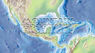
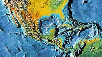
| Map identification: | 205 | Projection system: | Lambert's equal-area |
| Map coverage: | Central America | North boundary: | 36° 00' N |
| Image size (pixels): | 2,851 x 1,596 pixels | South boundary: | 05° 00' N |
| Image size (inches): | 9.50 x 5.32 inches | East boundary: | 58° 00' W |
| Image size (metric): | 241 x 135 millimeters | West boundary: | 125° 00' W |
| Resolution per pixel: | 2,500 meters | Horizontal scale: | 1:10,000,000 |
| RGB file size: | 12.9 Mb | Vertical scale: | 1:328,333 |
| CMYK file size: | 17.3 Mb | Vertical interval: | 100 meters |
| Grayscale file size: | 4.3 Mb | Vertical exaggeration: | 30.5 times normal |
|
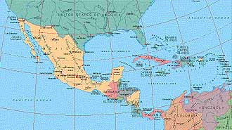
Countries, states and territories: |
Belize, Brazil, Cayman Islands, Colombia, Costa Rica, Cuba, Dominican Republic, El Salvador, Guatemala, Haiti, Honduras, Jamaica, Mexico, Netherlands Antilles, Nicaragua, Panama, Puerto Rico, Trindad & Tobago, Turks & Caicos Islands, U.S.A., Venezuela, |
||
|
| ||

|

| ||
|
Top left: Elevation low-contrast relief rendering Top right: Vegetation high-contrast relief rendering Middle left: Grayscale land-only relief rendering Middle right: Political low-contrast relief rendering Lower right: Geo-political vector Illustrator EPS maps Inventory of maps and masks within each map portfolio
|
 |

| Central America Map #205 - Buying Options |
||||||||
|
Central America Vector only EPS map (bottom left map image) |
Central America Relief/Vector Map (all maps on this page) |
America Continent Relief/Vector 16 Map Package |
Mountain High Maps Relief/Vector 78 Map Package | |||||
Any comments or problems with this
site? Please
let us know
- thank you!
© Digital Wisdom, Inc.